
Tropical Storm Erin is feared to become the first hurricane of the 2025 Atlantic season.
Looming just outside of Cape Verde right now, Storm Erin is gathering pace and strength – and could reach hurricane intensity today. It has caused significant flood damage across Cape Verde – and led to unconfirmed reports of deaths. It is moving west, and so is projected to wreak havoc on the Leeward Islands in the Caribbean Sea if it reaches the strength meteorologists anticipate. These include Antigua and Barbuda, popular tourist destinations.
Conditions are currently aiding the strengthening of the storm, it is understood. Chad Merrill, senior meteorologist with AccuWeather, said: “Several factors are working in its favour, including lack of dust, warm water and a lack of disruptive breezes (wind shear).”
For updates on Storm Erin, follow our live blog below…
Atlantic’s hurricane season continues
Tropical Storm Erin formed just west of the African coast on Monday morning, and is expected to move west quickly in the coming days.
The storm is the fifth of this year’s Atlantic hurricane season, and forecasters said its likely path and intensity will become clearer over the next few days.
While no warning or watches have been issued, so far, this could change in the coming days if the storm gets closer to land.
@X)
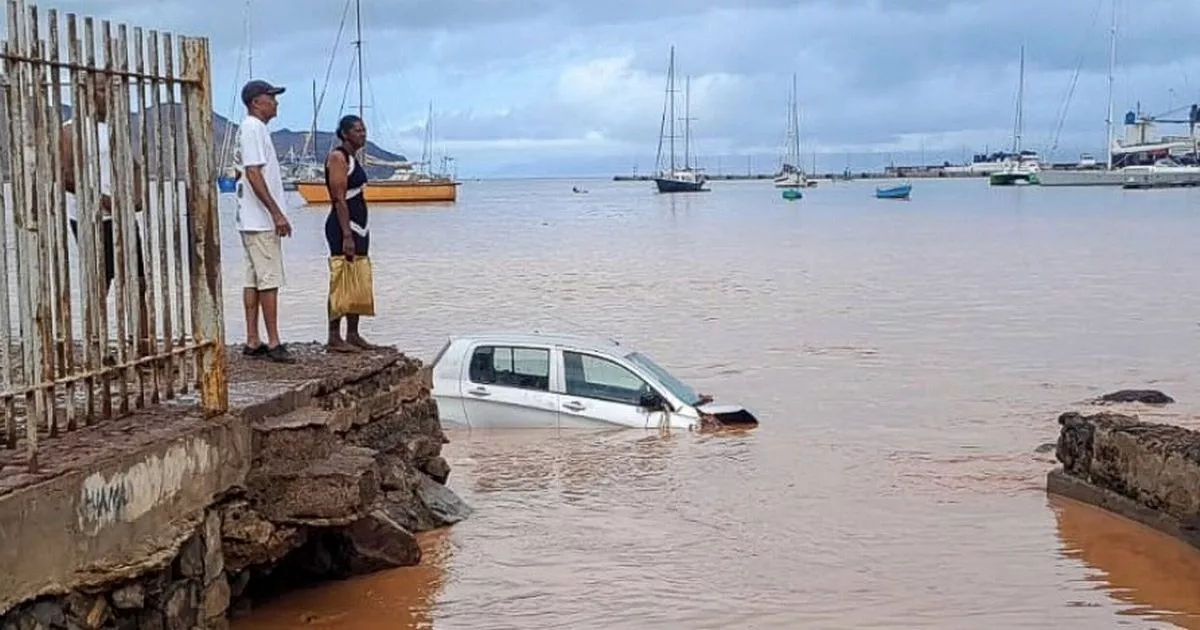
Significant flood damage across Cape Verde
Tropical Storm Erin has caused significant flood damage across Cape Verde.
Photographs show cars submerged in the sea, and people scrambling for safety.
There are unconfirmed reports of fatalities there.